Last Updated on June 29, 2023 9:22 am
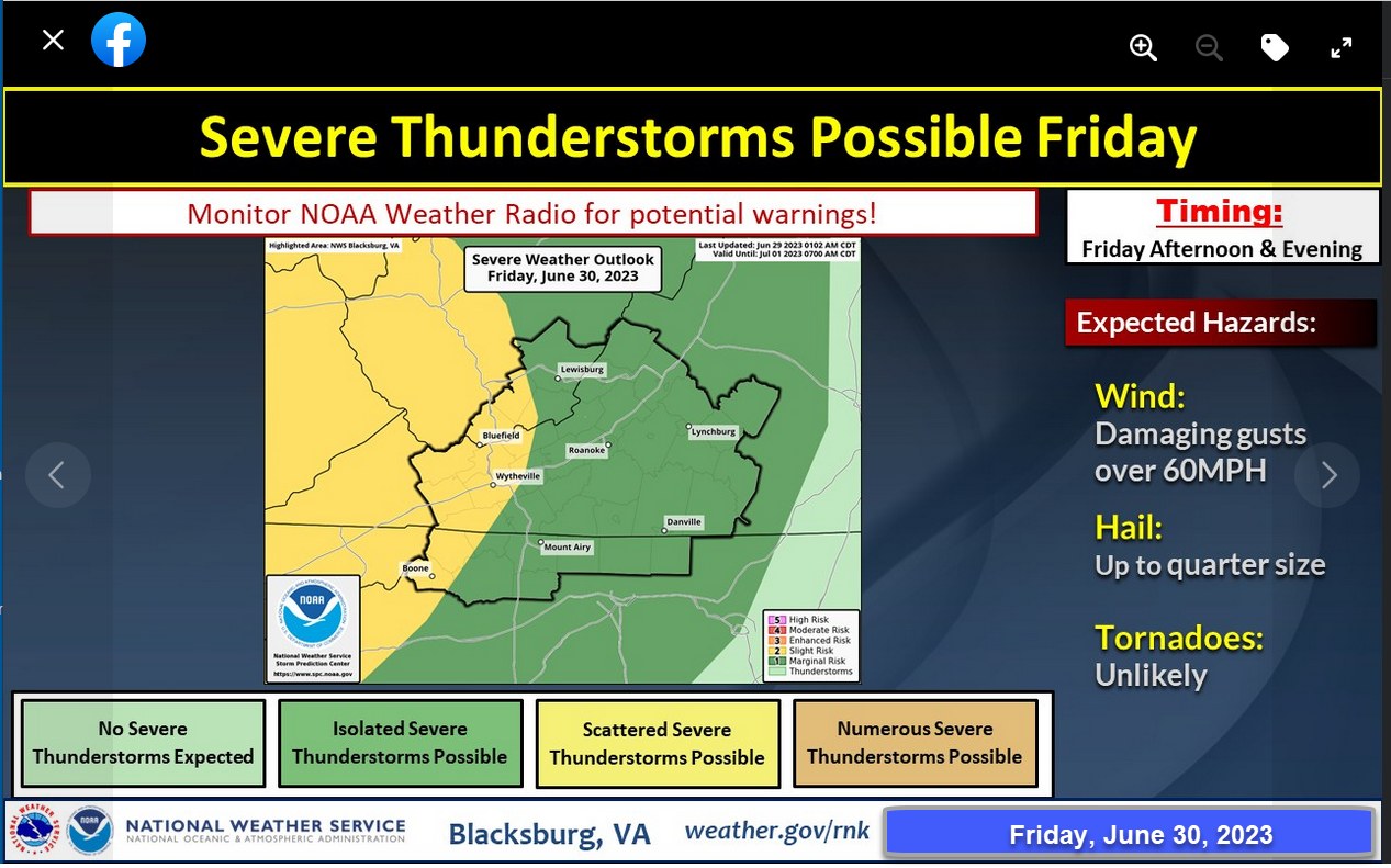
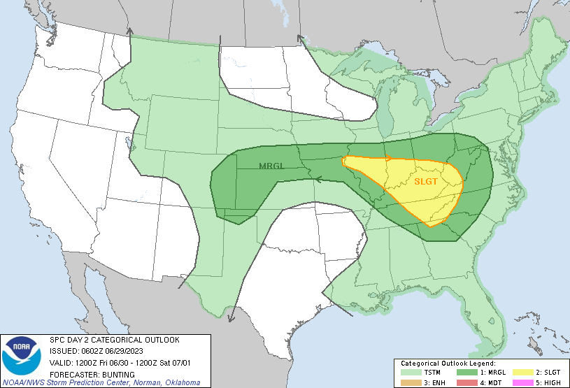
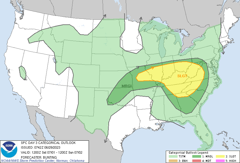
The National Weather Service Storm Prediction Center has issued a slight risk for severe thunderstorms, that includes the High Country, for Friday and Saturday.
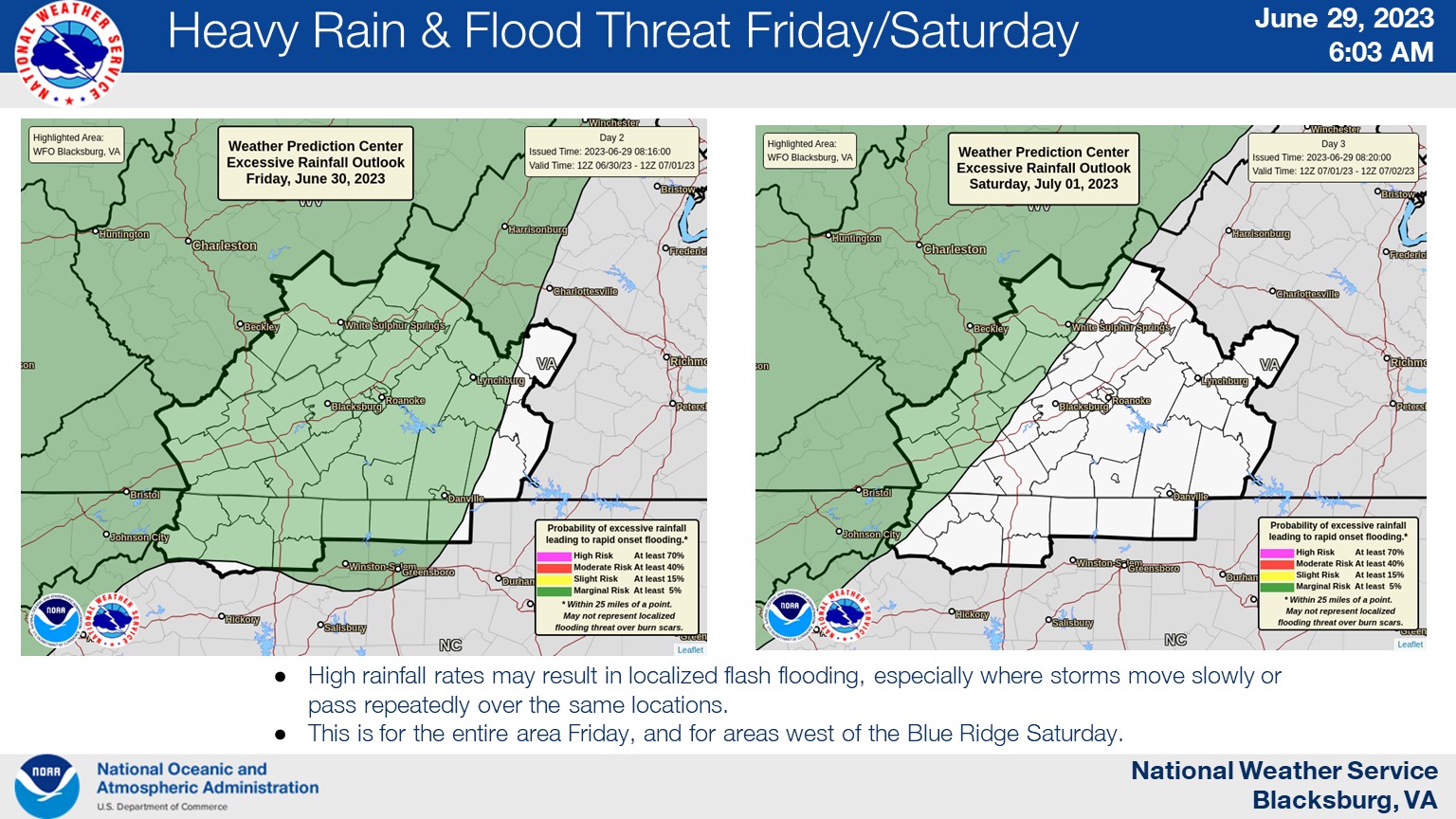
In the Thursday morning Hazardous Weather Outlook the National Weather Service (NWS) says “Strong to severe thunderstorms will be possible Friday and Saturday. Storms will be possible during the early morning hours, then again during the afternoon and evening. Damaging winds will be the main threat, along with large hail. Localized flooding will be possible.”
Convective Outlooks for Friday, June 30 & Saturday July 1
For the extended holiday time period the NWS forecast for Watauga County is:
Friday
Partly sunny with a chance of thunderstorms. A chance of showers in the morning, then showers likely in the afternoon. Highs in the upper 70s. West winds 5 to 10 mph. Chance of rain 70 percent.
Friday Night
Mostly cloudy with a chance of thunderstorms. Showers likely, mainly in the evening. Humid with lows in the mid 60s. West winds 5 to 10 mph. Chance of rain 70 percent.
Saturday
Partly sunny. A chance of showers and thunderstorms in the afternoon. Humid with highs in the lower 80s. West winds 10 to 15 mph. Chance of rain 30 percent.
Saturday Night
Mostly cloudy with a chance of showers and thunderstorms. Lows in the mid 60s. Chance of rain 40 percent.
Sunday Through Tuesday Night
Mostly cloudy with showers likely with a chance of thunderstorms. Highs around 80. Lows in the mid 60s. Chance of rain 60 percent.
Wednesday
Mostly sunny. A chance of showers and thunderstorms in the afternoon. Highs in the upper 70s. Chance of rain 50 percent.