






Last Updated on July 13, 2026 7:55 am
Multiple flood alerts are in effect across the High Country and surrounding region of northwest North Carolina Monday morning as a stalled upper-level low continues to produce slow-moving, heavy rainfall across the area.
The National Weather Service in Blacksburg issued the following alerts as of 7:40 a.m. Monday, July 13, 2026.
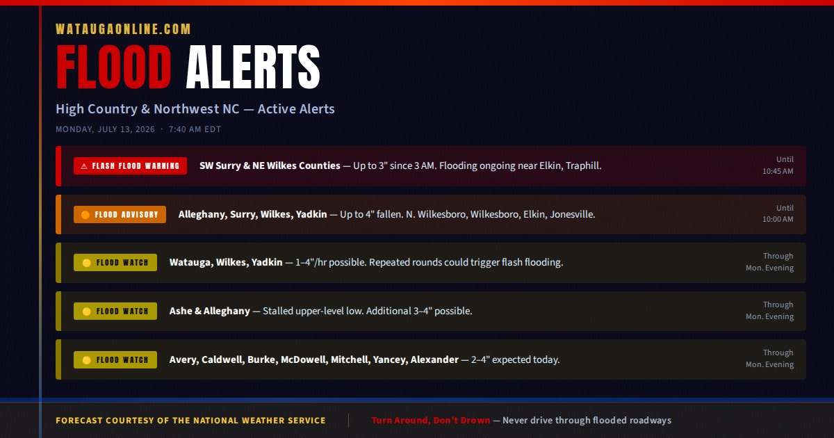
Flash Flood Warning — Until 10:45 a.m. Monday
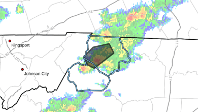
A Flash Flood Warning is in effect for southwestern Surry County and northeastern Wilkes County until 10:45 a.m. Up to three inches of rain fell across the warned area between 3 a.m. and 6:43 a.m., with up to two additional inches possible. Flash flooding is ongoing or expected to begin shortly.
Communities in the warned area include Elkin, Traphill, Benham, and State Road. Streams and drainages impacted include Grassy Creek, Elkin Creek, East Prong Roaring River, Little Sandy Creek, Camp Creek, Big Bugaboo Creek, Grassy Fork, and Big Sandy Creek.
Flood Advisory — Until 10:00 a.m. Monday
A Flood Advisory is in effect until 10:00 a.m. for Alleghany, Surry, Wilkes, and Yadkin counties in North Carolina, along with Grayson County in Virginia. Up to four inches of rain have already fallen across the advisory area. Minor flooding is ongoing or expected shortly in low-lying and poor drainage areas, with water reported over roadways.
Communities affected include North Wilkesboro, Wilkesboro, Elkin, Jonesville, Ronda, Traphill, and Mountain Park. Impacted drainages include Big Warrior Creek, Beaver Creek, Beaverdam Creek, Big Pine Creek, Big Bugaboo Creek, and Big Sandy Creek, among others.
Flood Watch — Watauga, Wilkes, and Yadkin Counties — Through Monday Evening
A Flood Watch is in effect for Watauga, Wilkes, and Yadkin counties, including the cities of Boone and Wilkesboro, through Monday evening. Slow-moving showers with embedded thunderstorms will continue through the day. Rainfall rates of one to four inches per hour are possible in the heaviest downpours, and repeated rounds of rain could trigger flash flooding.
Flood Watch — Ashe and Alleghany Counties — Through Monday Evening
A Flood Watch is in effect for Ashe and Alleghany counties, along with a large portion of southwest Virginia, through Monday evening. A cut-off upper-level low has stalled over the region, producing extremely slow storm motion. Precipitable water values of 1.8 to 2.1 inches are leading to very efficient and heavy rainfall. Additional localized totals of three to four inches are possible across the watch area.
Flood Watch — Avery and Surrounding Counties — Through Monday Evening
A Flood Watch issued by the National Weather Service in Greenville-Spartanburg is in effect for Avery, Caldwell, Burke, McDowell, Mitchell, Yancey, and Alexander counties through Monday evening. Heavy rain showers and embedded thunderstorms are expected to continue through the morning, with additional rounds of storms anticipated this afternoon. Twenty-four-hour rainfall totals of two to four inches are expected across much of the watch area, with locally higher amounts possible.
What to Do
Residents across all affected counties should monitor conditions closely and be prepared to act immediately if a Flash Flood Warning is issued for their location. Do not drive through flooded roadways — turn around, don't drown. Stay away from creeks, streams, and any low-lying flood-prone areas.
A Flash Flood Warning means flooding is occurring or imminent and immediate action may be required. A Flood Watch means conditions are favorable for flooding to develop. A Flood Advisory means minor flooding is occurring or expected in low-lying and poor drainage areas.
Additional updates will be posted as conditions change.