


Last Updated on September 12, 2023 5:58 pm
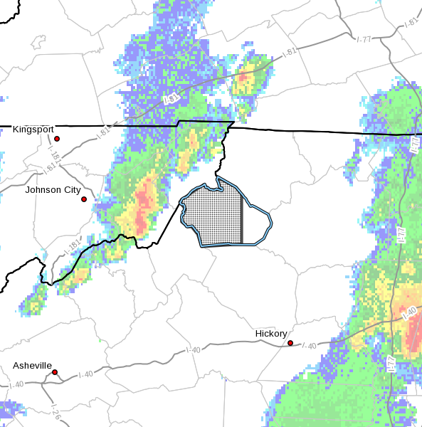
NCZ018-122230-
Watauga NC-
556 PM EDT Tue Sep 12 2023
…A STRONG THUNDERSTORM WILL IMPACT
WATAUGA COUNTY THROUGH 630 PM EDT…
At 555 PM EDT, Doppler radar was tracking a strong thunderstorm 7
miles east of Hampton, or 8 miles northwest of Beech Mountain, moving
east at 15 mph.
HAZARD…Wind gusts up to 50 mph and pea size hail.
SOURCE…Radar indicated.
IMPACT…Gusty winds could knock down tree limbs and blow around
unsecured objects. Minor hail damage to vegetation is
possible.
Locations impacted include…
Boone…
Blowing Rock…
Beech Mountain…
Foscoe…
Sugar Grove…
Blowing Rock In Caldwell County…
and Beech Mountain In Avery County.
PRECAUTIONARY/PREPAREDNESS ACTIONS…
If outdoors, consider seeking shelter inside a building.
Locally heavy rain will quickly reduce visibility and result in
ponding of water on roadways, standing water in low lying areas, and
minor flooding of creeks, streams, and areas of poor drainage.
Drivers are urged to slow down and use extra caution to avoid
hydroplaning.


