


Last Updated on April 16, 2024 1:56 pm
Special Weather Statement
National Weather Service BLACKSBURG VA
152 PM EDT Tue Apr 16 2024
NCZ018-161815-
Watauga NC-
152 PM EDT Tue Apr 16 2024
…A STRONG THUNDERSTORM WILL IMPACT WESTERN WATAUGA COUNTY THROUGH
215 PM EDT…
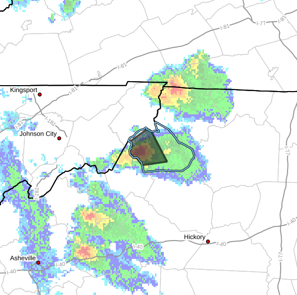
At 151 PM EDT, Doppler radar was tracking a strong thunderstorm over
Rominger, or over Beech Mountain, moving northeast at 5 mph.
HAZARD…Half inch hail.
SOURCE…Radar indicated.
IMPACT…Minor hail damage to vegetation is possible.
Locations impacted include…
Boone…
Beech Mountain…
Sugar Grove…
Foscoe…
Seven Devils…
Rominger…
and Valle Crucis.
PRECAUTIONARY/PREPAREDNESS ACTIONS…
Locally heavy rain will quickly reduce visibility and result in
ponding of water on roadways, standing water in low lying areas, and
minor flooding of creeks, streams, and areas of poor drainage.
Drivers are urged to slow down and use extra caution to avoid
hydroplaning.


