Last Updated on May 22, 2022 3:08 pm
NCZ033-501-221930-
Caldwell Mountains NC-Avery NC-
251 PM EDT Sun May 22 2022
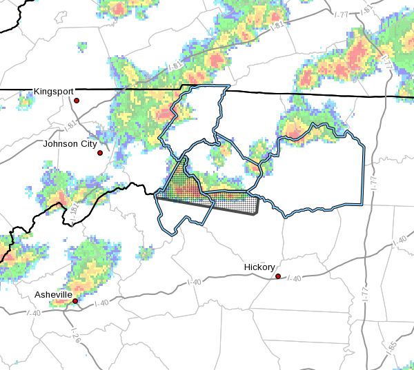
…A strong thunderstorm will impact portions of northwestern
Caldwell and central Avery Counties through 330 PM EDT…
At 250 PM EDT, Doppler radar was tracking a strong thunderstorm 4
miles south of Foscoe, or near Grandfather Mountain State Park,
moving east at 15 mph.
HAZARD…Wind gusts up to 40 mph and pea size hail.
SOURCE…Radar indicated.
IMPACT…Gusty winds could knock down tree limbs and blow around
unsecured objects. Minor damage to outdoor objects is
possible.
Locations impacted include…
Newland, Blowing Rock In Caldwell County, Banner Elk, Elk Park, Beech
Mountain In Avery County, Sugar Mountain, Seven Devils, Grandfather
Mountain State Park, B.R. Parkway-Linville Falls To Grandfather and
Linville.
PRECAUTIONARY/PREPAREDNESS ACTIONS…
If outdoors, consider seeking shelter inside a building.
Torrential rainfall is also occurring with this storm and may lead to
localized flooding. Do not drive your vehicle through flooded
roadways.
Frequent cloud to ground lightning is occurring with this storm.
Lightning can strike 10 miles away from a thunderstorm. Seek a safe
shelter inside a building or vehicle.