Last Updated on June 15, 2022 5:10 pm
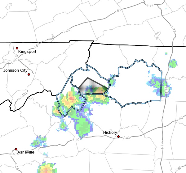
NCZ018-152145-
Watauga NC-
507 PM EDT Wed Jun 15 2022
…A strong thunderstorm will impact portions of southern Watauga
County through 545 PM EDT…
At 507 PM EDT, Doppler radar was tracking a strong thunderstorm over
Aho, or near Blowing Rock, moving northwest at 10 mph.
HAZARD…Winds in excess of 40 mph and pea size hail.
SOURCE…Radar indicated.
IMPACT…Gusty winds could knock down tree limbs and blow around
unsecured objects. Minor damage to outdoor objects is
possible.
Locations impacted include…
Boone…
Blowing Rock…
Foscoe…
Blowing Rock In Caldwell County…
Seven Devils…
Lovill…
and Aho.
PRECAUTIONARY/PREPAREDNESS ACTIONS…
If outdoors, consider seeking shelter inside a building.
Locally heavy rain will quickly reduce visibility and result in
ponding of water on roadways, standing water in low lying areas, and
minor flooding of creeks, streams, and areas of poor drainage.
Drivers are urged to slow down and use extra caution to avoid
hydroplaning.
This storm may intensify, so be certain to monitor local radio
stations and available television stations for additional information
and possible warnings from the National Weather Service.