Last Updated on August 7, 2021 4:42 pm
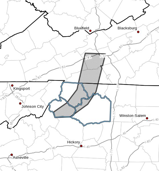
NCZ001-002-018-019-VAZ009-012-015-072100-
Ashe NC-Wilkes NC-Watauga NC-Alleghany NC-Grayson VA-Wythe VA-
Smyth VA-
434 PM EDT Sat Aug 7 2021
…Strong thunderstorms will impact portions of
western Alleghany, northwestern Wilkes, southern Watauga and eastern
Ashe Counties in northwestern North Carolina, east central Smyth,
southwestern Wythe and central Grayson Counties in southwestern
Virginia through 500 PM EDT…
At 434 PM EDT, Doppler radar was tracking strong thunderstorms along
a line extending from Rural Retreat to near Scottville to Fleetwood
to near Bakersville. Movement was east at 20 mph.
HAZARD…Winds in excess of 30 mph.
SOURCE…Radar indicated.
IMPACT…Gusty winds could knock down tree limbs and blow around
unsecured objects.
Locations impacted include…
Boone…
Wytheville…
Sparta…
Jefferson…
Rural Retreat…
West Jefferson…
and Blowing Rock.
PRECAUTIONARY/PREPAREDNESS ACTIONS…
If outdoors, consider seeking shelter inside a building.
Torrential rainfall is also occurring with these storms and may lead
to localized flooding. Do not drive your vehicle through flooded
roadways.