


Last Updated on March 3, 2023 5:40 pm
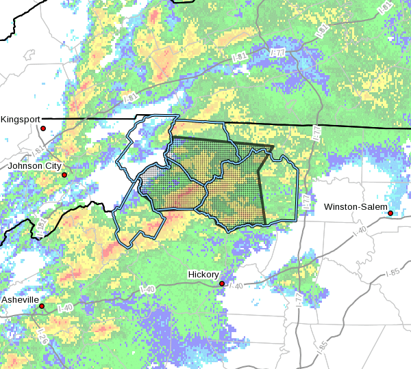
NCZ001-002-018-019-032300-
Ashe NC-Wilkes NC-Watauga NC-Alleghany NC-
534 PM EST Fri Mar 3 2023
…Clusters of showers and thunderstorms, capable of producing
strong gusty winds, will impact portions of southwestern Alleghany,
Wilkes, Watauga and Ashe Counties in northwestern North Carolina
through 600 PM EST…
At 529 PM EST, Doppler radar was tracking clusters of showers and
thunderstorms from Todd to near Deep Gap. Additional showers, and a
few stronger thunderstorms extended southwest from Sugar Mountain.
Movement of the showers and storms was east-northeast, in excess
of 60 mph.
HAZARD…Winds in excess of 40 mph.
SOURCE…Radar indicated.
IMPACT…Gusty winds could knock down tree limbs and blow around
unsecured objects.
Locations impacted include…
Boone…
North Wilkesboro…
Wilkesboro…
Jefferson…
West Jefferson…
Blowing Rock…
and Beech Mountain.
PRECAUTIONARY/PREPAREDNESS ACTIONS…
If outdoors, consider seeking shelter inside a building.
Additional statements will be issued as conditions warrant.


