


Last Updated on January 12, 2023 2:50 pm
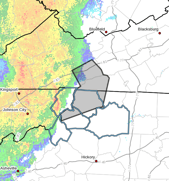
NCZ001-002-018-VAZ009-015-122030-
Ashe NC-Watauga NC-Alleghany NC-Grayson VA-Smyth VA-
247 PM EST Thu Jan 12 2023
…Strong thunderstorms will impact portions of
western Alleghany, northwestern Watauga and Ashe Counties in
northwestern North Carolina, Smyth and western Grayson Counties in
southwestern Virginia through 330 PM EST…
At 246 PM EST, Doppler radar was tracking strong thunderstorms along
a line extending from 6 miles south of Abingdon to near Mountain City
to near Peoria. Movement was east at 65 mph.
HAZARD…Wind gusts up to 50 mph.
SOURCE…Radar indicated.
IMPACT…Gusty winds could knock down tree limbs and blow around
unsecured objects.
Locations impacted include…
Marion…
Chilhowie…
Jefferson…
West Jefferson…
Beech Mountain…
Lansing…
and Mouth Of Wilson.
PRECAUTIONARY/PREPAREDNESS ACTIONS…
If outdoors, consider seeking shelter inside a building.


