


Last Updated on February 15, 2021 6:14 pm
NCZ001>006-018>020-VAZ010>020-022>024-032>035-043>047-058-059-
160300-
Ashe-Alleghany NC-Surry-Stokes-Rockingham-Caswell-Watauga-Wilkes-
Yadkin-Bland-Giles-Wythe-Pulaski-Montgomery-Grayson-Carroll-Floyd-
Craig-Alleghany VA-Bath-Roanoke-Botetourt-Rockbridge-Patrick-
Franklin-Bedford-Amherst-Henry-Pittsylvania-Campbell-Appomattox-
Buckingham-Halifax-Charlotte-
Including the cities of West Jefferson, Sparta, Dobson, Danbury,
Eden, Yanceyville, Boone, Wilkesboro, Yadkinville, Bland,
Pearisburg, Wytheville, Radford, Pulaski, Blacksburg,
Independence, Whitetop, Troutdale, Volney, Galax, Floyd,
New Castle, Clifton Forge, Covington, Hot Springs, Roanoke,
Salem, Fincastle, Lexington, Buena Vista, Stuart, Rocky Mount,
Bedford, Amherst, Martinsville, Danville, Lynchburg, Appomattox,
South Boston, and Keysville
559 PM EST Mon Feb 15 2021
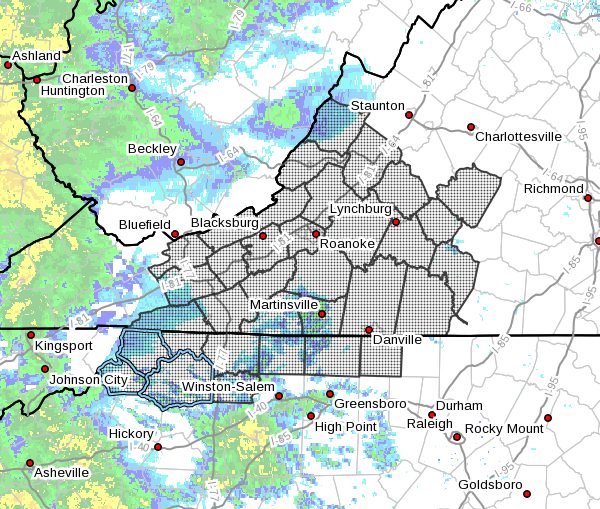
…Areas of fog this evening…
Areas of fog will restrict the visibility this evening.
Visibilities of 1 mile or less are expected. Patchy dense fog with
visibility of a quarter mile or less is possible near the Blue
Ridge, impacting Interstate 81 near Christiansburg mountain, and
along interstate 77 near Fancy Gap.
The visibility is expected to improve by midnight as rain
overspreads the region. The rain should allow the fog to lift,
however rain and wet roads will become an additional hazard to
compensate for, during the overnight.
Regardless of the impinging weather hazard, please use caution if
traveling. Slow down and allow plenty of room between you and the
vehicle in front of you. Greater braking distance is required when
roads are wet and the visibility is poor.


