


Last Updated on July 13, 2023 5:00 pm
NCZ001-018-132130-
Ashe NC-Watauga NC-
455 PM EDT Thu Jul 13 2023
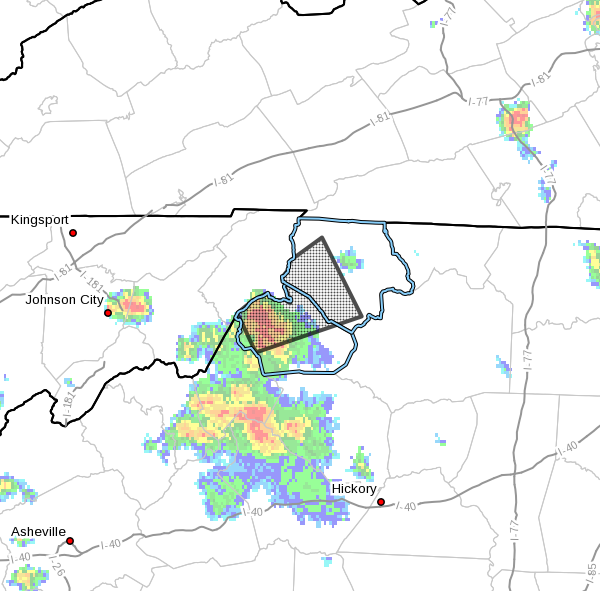
…A strong thunderstorm will impact portions of
central Watauga and western Ashe Counties through 530 PM EDT…
At 455 PM EDT, Doppler radar was tracking a strong thunderstorm over
Sugar Grove, moving northeast at 25 mph.
HAZARD…Winds in excess of 30 mph and pea size hail.
SOURCE…Radar indicated.
IMPACT…Gusty winds could knock down tree limbs and blow around
unsecured objects. Minor damage to outdoor objects is
possible.
Locations impacted include…
Boone…
Sugar Grove…
Todd…
Ashland…
Trout…
Fleetwood…
and Baldwin.
PRECAUTIONARY/PREPAREDNESS ACTIONS…
If outdoors, consider seeking shelter inside a building.


