


Last Updated on April 10, 2021 6:38 pm
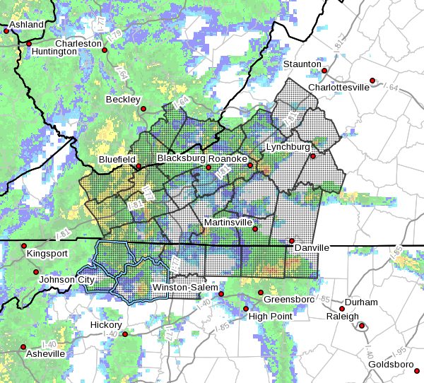
NCZ001>006-018>020-VAZ007-009>018-022>024-032>035-043>045-
WVZ042>044-102345-
Ashe-Alleghany NC-Surry-Stokes-Rockingham-Caswell-Watauga-Wilkes-
Yadkin-Tazewell-Smyth-Bland-Giles-Wythe-Pulaski-Montgomery-
Grayson-Carroll-Floyd-Craig-Roanoke-Botetourt-Rockbridge-Patrick-
Franklin-Bedford-Amherst-Henry-Pittsylvania-Campbell-Mercer-
Summers-Monroe-
Including the cities of West Jefferson, Sparta, Dobson, Danbury,
Eden, Yanceyville, Boone, Wilkesboro, Yadkinville, Tazewell,
Marion, Bland, Pearisburg, Wytheville, Radford, Pulaski,
Blacksburg, Independence, Whitetop, Troutdale, Volney, Galax,
Floyd, New Castle, Roanoke, Salem, Fincastle, Lexington,
Buena Vista, Stuart, Rocky Mount, Bedford, Amherst, Martinsville,
Danville, Lynchburg, Bluefield, Flat Top, Hinton, Hix, and Union
633 PM EDT Sat Apr 10 2021
…MODERATE TO HEAVY SHOWERS WILL IMPACT THE AREA THROUGH 745
PM…
Showers overspreading the area will be heavy at times, with
rainfall rates of up to 1 to 1.5 inches an hour. The heavier
showers are moving at a good clip, but repeated rainfall may lead
to ponding of water and low lying flooding in poor drainage or
urban areas.
If traveling, be alert to water on roads. Slow down to avoid
hydroplaning.


