Last Updated on August 7, 2021 3:32 pm
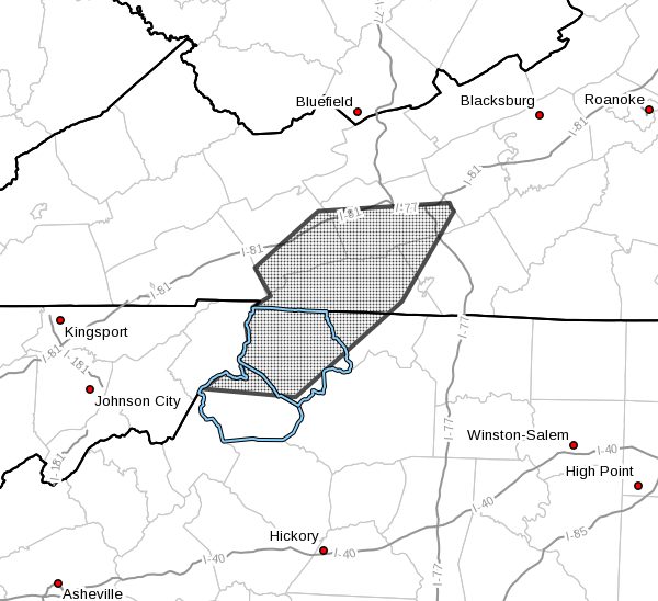
NCZ001-002-018-VAZ009-012-015-016-072030-
Ashe NC-Watauga NC-Alleghany NC-Grayson VA-Wythe VA-Smyth VA-
Carroll VA-
328 PM EDT Sat Aug 7 2021
…Strong thunderstorms will impact portions of
northwestern Alleghany, northern Watauga and Ashe Counties in
northwestern North Carolina, southeastern Smyth, southern Wythe,
northwestern Carroll and Grayson Counties in southwestern Virginia
through 430 PM EDT…
At 328 PM EDT, Doppler radar was tracking strong thunderstorms along
a line extending from Rural Retreat to 9 miles northeast of Hampton.
Movement was east at 20 mph.
HAZARD…Winds in excess of 30 mph.
SOURCE…Radar indicated.
IMPACT…Gusty winds could knock down tree limbs and blow around
unsecured objects.
Locations impacted include…
Wytheville…
Marion…
Jefferson…
Rural Retreat…
West Jefferson…
Independence…
and Fries.
PRECAUTIONARY/PREPAREDNESS ACTIONS…
If outdoors, consider seeking shelter inside a building.
Locally heavy rain will quickly reduce visibility and result in
ponding of water on roadways, standing water in low lying areas, and
minor flooding of creeks, streams, and areas of poor drainage.
Drivers are urged to slow down and use extra caution to avoid
hydroplaning.