Last Updated on May 21, 2022 3:00 pm
NCZ001-018-211930-
Ashe NC-Watauga NC-
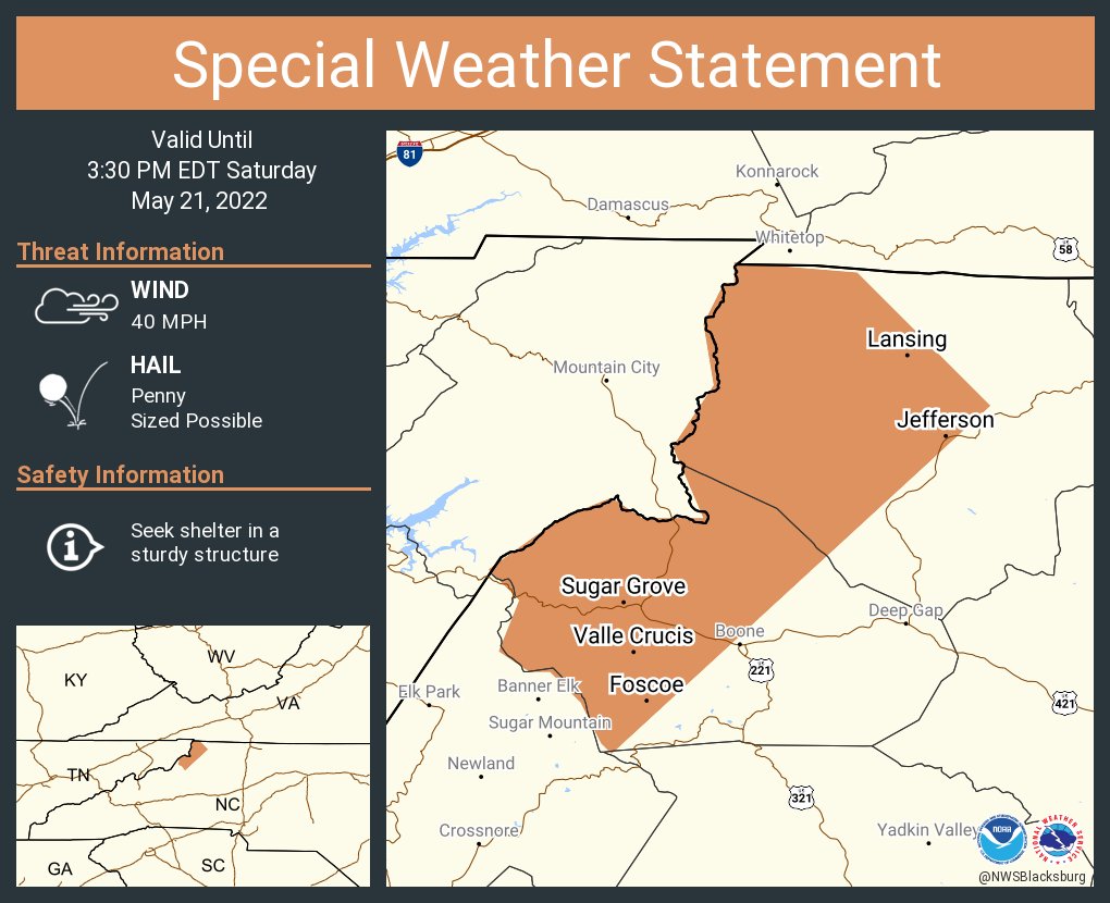
250 PM EDT Sat May 21 2022
…A strong thunderstorm will impact portions of
western Watauga and western Ashe Counties through 330 PM EDT…
At 250 PM EDT, Doppler radar was tracking a strong thunderstorm over
Rominger, or near Beech Mountain, moving northeast at 25 mph.
HAZARD…Winds in excess of 40 mph and penny size hail.
SOURCE…Radar indicated.
IMPACT…Gusty winds could knock down tree limbs and blow around
unsecured objects. Minor damage to outdoor objects is
possible.
Locations impacted include…
Boone…
Jefferson…
West Jefferson…
Beech Mountain…
Lansing…
Foscoe…
and Sugar Grove.
PRECAUTIONARY/PREPAREDNESS ACTIONS…
If outdoors, consider seeking shelter inside a building.
Torrential rainfall is also occurring with this storm and may lead to
localized flooding. Do not drive your vehicle through flooded
roadways.