Last Updated on June 8, 2022 4:22 pm
Special Weather Statement
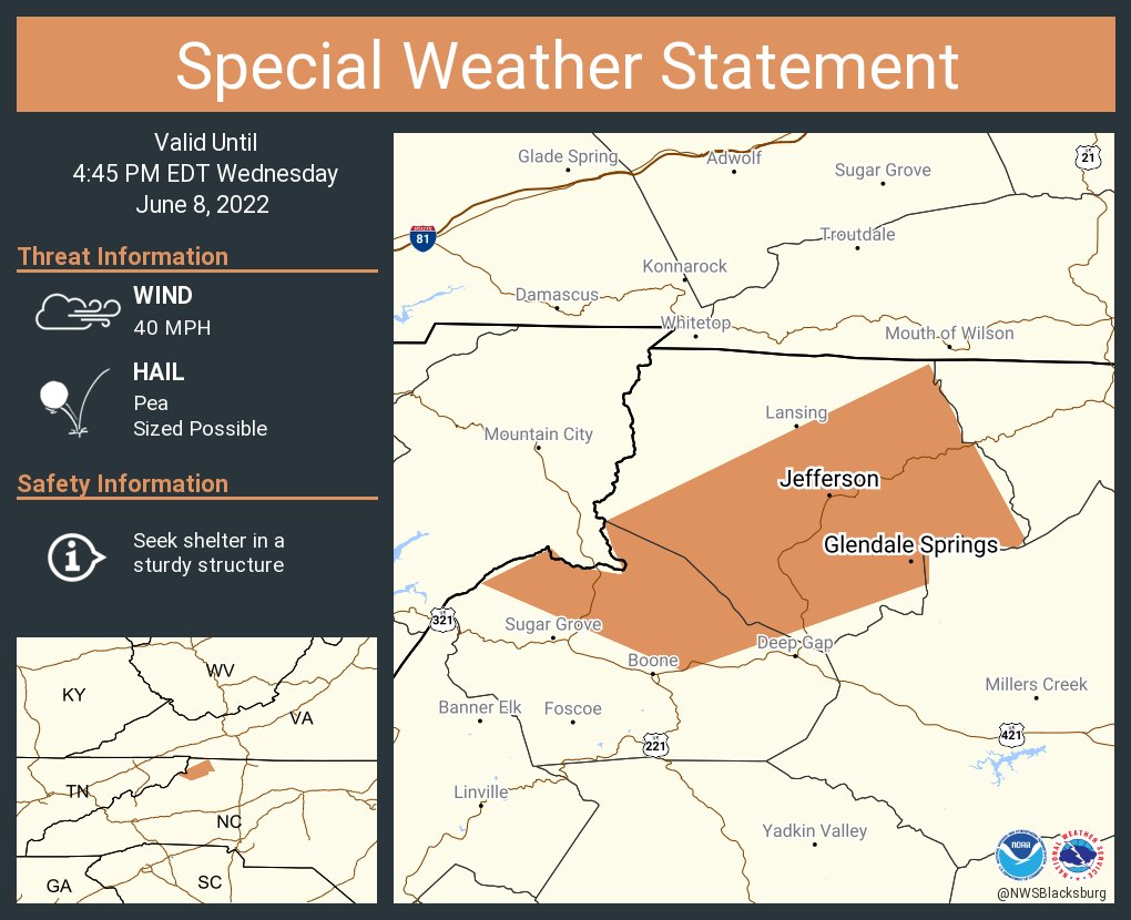
National Weather Service BLACKSBURG VA
418 PM EDT Wed Jun 8 2022
NCZ001-018-082045-
Ashe NC-Watauga NC-
418 PM EDT Wed Jun 8 2022
…A strong thunderstorm will impact portions of
northern Watauga and Ashe Counties through 445 PM EDT…
At 417 PM EDT, Doppler radar was tracking a strong thunderstorm near
Todd, moving northeast at 30 mph.
HAZARD…Winds in excess of 40 mph and pea size hail.
SOURCE…Radar indicated.
IMPACT…Gusty winds could knock down tree limbs and blow around
unsecured objects. Minor damage to outdoor objects is
possible.
Locations impacted include…
Jefferson…
West Jefferson…
Lansing…
Glendale Springs…
Todd…
Laurel Springs…
and Ashland.
PRECAUTIONARY/PREPAREDNESS ACTIONS…
If outdoors, consider seeking shelter inside a building.
Torrential rainfall is also occurring with this storm and may lead to
localized flooding. Do not drive your vehicle through flooded
roadways.
Frequent cloud to ground lightning is occurring with this storm.
Lightning can strike 10 miles away from a thunderstorm. Seek a safe
shelter inside a building or vehicle.