Last Updated on July 9, 2022 12:57 pm
NCZ001-091745-
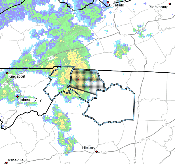
Ashe NC-
1250 PM EDT Sat Jul 9 2022
…Showers with heavy rainfall and possibly an embedded thunderstorm
will impact much of Ashe County through 145 PM EDT…
At 1246 PM EDT, Doppler radar was tracking a cluster of showers
with heavy rainfall and embedded isolated thunderstorms moving from
Johnson County TN into Ashe County NC. The activity is moving east
at 20 mph.
HAZARD…Very heavy rainfall
SOURCE…Radar indicated.
IMPACT…Flooding of low-lying and normally flood prone areas such
as low water crossings and poor drainage areas.
Locations impacted include…
Jefferson…
West Jefferson…
Lansing…
Laurel Springs…
Glendale Springs…
Ashland…
and Trout.
PRECAUTIONARY/PREPAREDNESS ACTIONS…
If outdoors, consider seeking shelter inside a building.
Locally heavy rain will quickly reduce visibility and result in
ponding of water on roadways, standing water in low lying areas, and
minor flooding of creeks, streams, and areas of poor drainage.
Drivers are urged to slow down and use extra caution to avoid
hydroplaning.