


Last Updated on July 10, 2021 6:57 pm
NCC009-189-102345-
/O.NEW.KRNK.SV.W.0074.210710T2249Z-210710T2345Z/
BULLETIN – IMMEDIATE BROADCAST REQUESTED
Severe Thunderstorm Warning
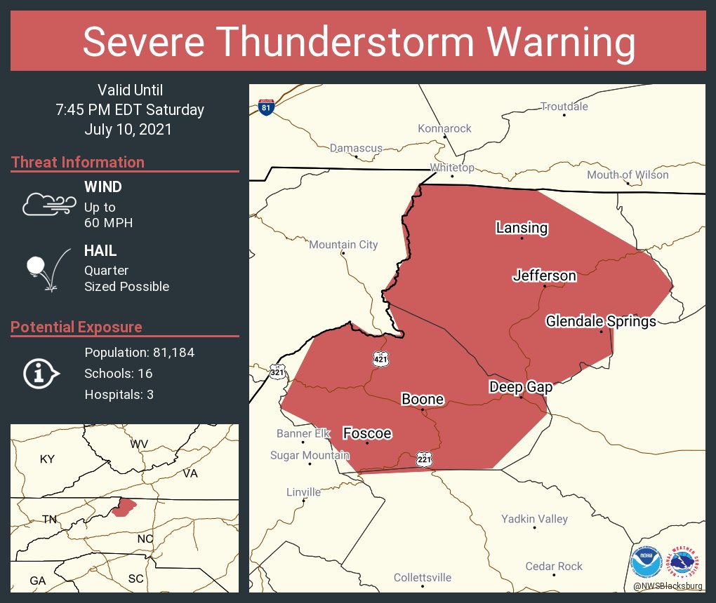
National Weather Service BLACKSBURG VA
649 PM EDT Sat Jul 10 2021
The National Weather Service in BLACKSBURG has issued a
- Severe Thunderstorm Warning for…
Watauga County in northwestern North Carolina…
Ashe County in northwestern North Carolina… - Until 745 PM EDT.
- At 649 PM EDT, severe thunderstorms were located along a line
extending from near Flatwood to Valle Crucis, moving southeast at
15 mph.
HAZARD…60 mph wind gusts and quarter size hail.
SOURCE…Radar indicated.
IMPACT…Hail damage to vehicles is expected. Expect wind damage
to roofs, siding, and trees.
- Locations impacted include…
Boone…
Jefferson…
West Jefferson…
Blowing Rock…
Beech Mountain…
Lansing…
and Foscoe.
This includes The following Location Appalachian State University.
PRECAUTIONARY/PREPAREDNESS ACTIONS…
Prepare immediately for large hail and damaging winds, as well as
deadly cloud to ground lightning. For your safety, move to an
interior room on the lowest floor of a sturdy building. Stay away
from windows.
Locally heavy rain will quickly reduce visibility and result in
ponding of water on roadways, standing water in low lying areas, and
minor flooding of creeks, streams, and areas of poor drainage.
Drivers are urged to slow down and use extra caution to avoid
hydroplaning.
When it is safe to do so, please send your reports of hail of any
size, as well as reports of any wind damage, including downed trees
or large limbs, to the National Weather Service by calling toll free
at 1…8 6 6…2 1 5…4 3 2 4. Reports and pictures can also be
shared on the National Weather Service Blacksburg Facebook page and
on Twitter.


