Last Updated on February 13, 2022 8:48 am
Update Sunday Oct 8 – Flash Flood Watch in effect from Sunday evening through Monday morning. Wind Advisory in effect from 6pm this evening until noon Monday.
Update Saturday October 7 – The High Country will feel some impacts from what is now Hurricane Nate, as the storm moves inland and heads toward the spine of the Appalachians.
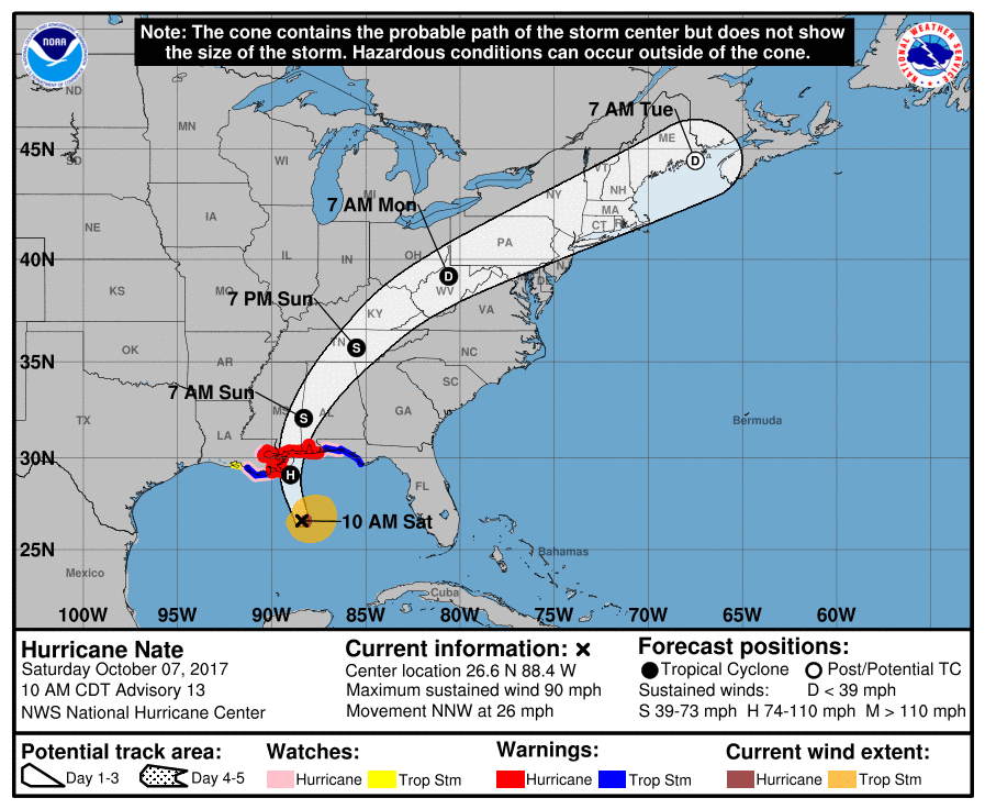
At 11am Eastern Time Saturday morning, the center of Nate was located at 180 miles South-Southeast of the mouth of the Mississippi River, with maximum sustained winds of 90 mph. The storm is forecast to be a Category 2 hurricane when it makes landfall along the Gulf Coast on Saturday night.
Locally, the National Weather Services says the heaviest impacts will be Sunday afternoon into Monday with the potential for heavy rains. Rainfall totals could be in the 2 to 4 plus inch range. Strong winds will be a major concern as well, NWS adds.
National Hurricane Center forecast track 11am Saturday Oct 7
Thursday October 5 – The remnants of what is now Tropical Storm Nate could impact the High Country next week.
The tropical storm could intensify enough to become Hurricane Nate over the weekend, according to the National Weather Service (NWS). In a Thursday afternoon briefing NWS said the current National Hurricane Center track has Nate riding up just west of the mountains through early Monday before jetting northeast across West Va to the Mid-Atlantic coast by early Tuesday. NWS cautions that,”However still lots of uncertainty with the strength/track of Nate given model differences in handling this small feature especially since so far south of the area.”
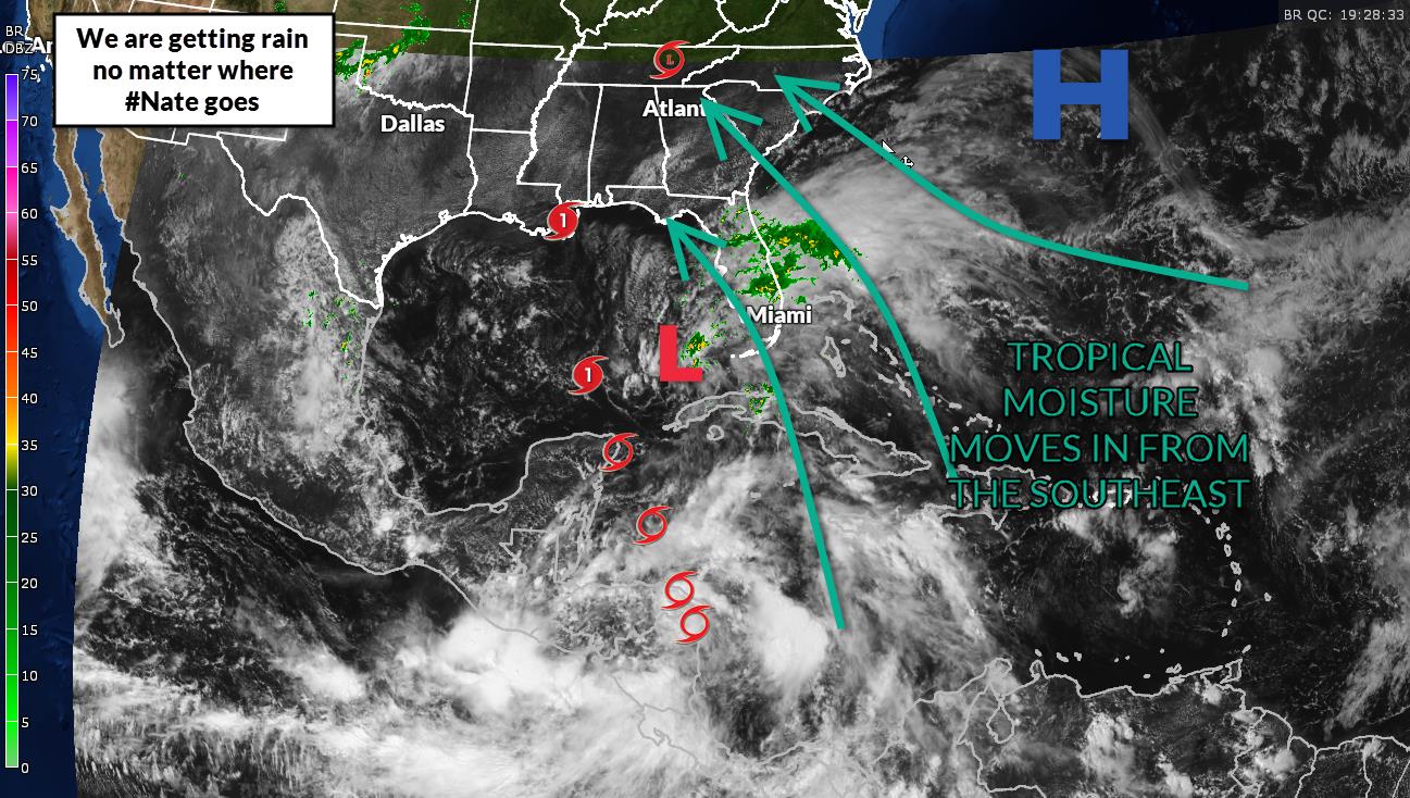
Brad Panovich, Chief Meteorologist for NBC Charlotte, said on Thursday that even if Nate goes west we are still getting rain due to other factors. Brad also noted that we may not see as much but 1-4″ likely still.
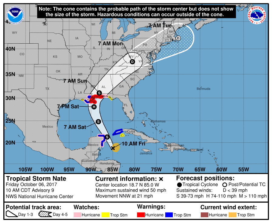
As of the 5pm Thursday update from the National Hurricane Center, the center of Tropical Storm Nate was located 40 miles West-Southwest of Puerto Lempira Honduras.
Graphic: Brad Panovich
National Hurricane Center forecast track 11am Friday Oct 6