


Last Updated on July 26, 2022 10:35 am
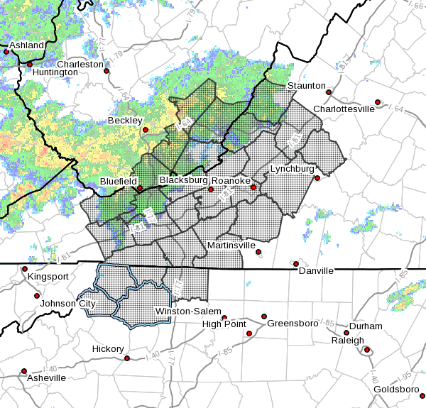
A stalled front from the Mid Atlantic region into the Tennessee Valley will produce periods of showers and thunderstorms this afternoon and evening.
NCZ001>003-018-019-VAZ007-009>020-022>024-032>035-WVZ042>044-507-508-
262230-
/O.NEW.KRNK.FA.A.0004.220726T1429Z-220727T0400Z/
/00000.0.ER.000000T0000Z.000000T0000Z.000000T0000Z.OO/
Ashe-Alleghany NC-Surry-Watauga-Wilkes-Tazewell-Smyth-Bland-Giles-
Wythe-Pulaski-Montgomery-Grayson-Carroll-Floyd-Craig-Alleghany VA-
Bath-Roanoke-Botetourt-Rockbridge-Patrick-Franklin-Bedford-Amherst-
Mercer-Summers-Monroe-Eastern Greenbrier-Western Greenbrier-
Including the cities of Boone, Pearisburg, Salem, Galax, Marion,
Pulaski, Lexington, Floyd, Fincastle, Lewisburg, Radford,
Wytheville, Independence, Volney, Duo, Bedford, Dobson, Stuart,
Clifton Forge, Covington, Hot Springs, Troutdale, West Jefferson,
New Castle, White Sulphur Springs, Rainelle, Amherst, Alderson,
Sparta, Quinwood, Hix, Buena Vista, Bland, Whitetop, Wilkesboro,
Union, Rocky Mount, Flat Top, Roanoke, Hinton, Blacksburg,
Bluefield, and Tazewell
1029 AM EDT Tue Jul 26 2022
…FLOOD WATCH IN EFFECT THROUGH THIS EVENING…
- WHAT…Flooding caused by excessive rainfall is possible.
- WHERE…Portions of North Carolina, Virginia and southeast West
Virginia, including the following areas, in North Carolina,
Alleghany NC, Ashe, Surry, Watauga and Wilkes. In Virginia,
Alleghany VA, Amherst, Bath, Bedford, Bland, Botetourt, Carroll,
Craig, Floyd, Franklin, Giles, Grayson, Montgomery, Patrick,
Pulaski, Roanoke, Rockbridge, Smyth, Tazewell and Wythe. In
southeast West Virginia, Eastern Greenbrier, Mercer, Monroe,
Summers and Western Greenbrier. - WHEN…Through this evening.
- IMPACTS…Excessive runoff may result in flooding of rivers,
creeks, streams, and other low-lying and flood-prone locations.
Flooding may occur in poor drainage and urban areas. Area creeks
and streams are running high and could flood with more heavy rain. - ADDITIONAL DETAILS…
- 1 to 3 inches of rain has fallen over part of southwest
Virginia, Northwest North Carolina and southeast West
Virginia, saturating the ground and leaving the area ripe for
flooding. Showers and thunderstorms are expected to produce
another 1 to 3 inches of rain this afternoon and evening,
with locally higher amounts. In addition, any of the stronger
thunderstorms will have intense rainfall rates of over 2
inches per hour. These rainfall rates could quickly overwhelm
local drainage. - http://www.weather.gov/safety/flood
PRECAUTIONARY/PREPAREDNESS ACTIONS…
You should monitor later forecasts and be alert for possible Flood
Warnings. Those living in areas prone to flooding should be prepared
to take action should flooding develop.


