Last Updated on January 27, 2024 6:49 pm
Flood Watch
National Weather Service Blacksburg VA
640 PM EST Sat Jan 27 2024
NCZ001>006-018>020-VAZ007-009>020-022>024-032>035-043>047-058-059-
WVZ042>044-507-508-280745-
/O.CON.KRNK.FA.A.0004.000000T0000Z-240128T1200Z/
/00000.0.ER.000000T0000Z.000000T0000Z.000000T0000Z.OO/
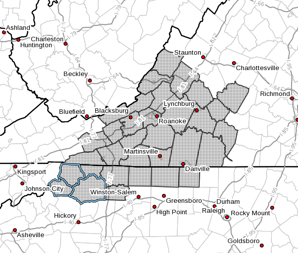
Ashe-Alleghany NC-Surry-Stokes-Rockingham-Caswell-Watauga-Wilkes-
Yadkin-Tazewell-Smyth-Bland-Giles-Wythe-Pulaski-Montgomery-
Grayson-Carroll-Floyd-Craig-Alleghany VA-Bath-Roanoke-Botetourt-
Rockbridge-Patrick-Franklin-Bedford-Amherst-Henry-Pittsylvania-
Campbell-Appomattox-Buckingham-Halifax-Charlotte-Mercer-Summers-
Monroe-Eastern Greenbrier-Western Greenbrier-
Including the cities of Dobson, Yanceyville, Boone, Fincastle,
Sparta, Union, Rainelle, Alderson, Lynchburg, Quinwood,
Lexington, Independence, Clifton Forge, Duo, New Castle,
Covington, Bedford, Amherst, Bland, White Sulphur Springs,
Roanoke, Danville, Martinsville, Keysville, Bluefield, Galax,
South Boston, Pearisburg, Wytheville, Volney, Appomattox, Buena
Vista, Tazewell, Hix, Salem, Pulaski, Marion, Yadkinville,
Blacksburg, Hot Springs, Flat Top, Troutdale, Eden, Floyd,
Wilkesboro, West Jefferson, Radford, Rocky Mount, Lewisburg,
Hinton, Stuart, Danbury, and Whitetop
640 PM EST Sat Jan 27 2024
…FLOOD WATCH REMAINS IN EFFECT THROUGH SUNDAY MORNING…
- WHAT…Flooding caused by excessive rainfall continues to be
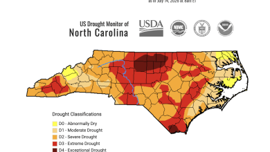
possible. - WHERE…Portions of North Carolina, including the following areas,
Alleghany NC, Ashe, Caswell, Rockingham, Stokes, Surry, Watauga,
Wilkes and Yadkin, Virginia, including the following areas,
Alleghany VA, Amherst, Appomattox, Bath, Bedford, Bland,
Botetourt, Buckingham, Campbell, Carroll, Charlotte, Craig, Floyd,
Franklin, Giles, Grayson, Halifax, Henry, Montgomery, Patrick,
Pittsylvania, Pulaski, Roanoke, Rockbridge, Smyth, Tazewell and
Wythe, and southeast West Virginia, including the following areas,
Eastern Greenbrier, Mercer, Monroe, Summers and Western Greenbrier. - WHEN…Through Sunday morning.
- IMPACTS…Excessive runoff may result in flooding of rivers,
creeks, streams, and other low-lying and flood-prone locations.
Creeks and streams may rise out of their banks. Flooding may occur
in poor drainage and urban areas. - ADDITIONAL DETAILS…
- http://www.weather.gov/safety/flood
PRECAUTIONARY/PREPAREDNESS ACTIONS…
You should monitor later forecasts and be alert for possible Flood
Warnings. Those living in areas prone to flooding should be prepared
to take action should flooding develop.