


Last Updated on May 6, 2024 2:32 pm
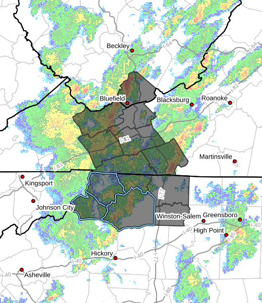
Multiple rounds of showers and thunderstorms will cross southeast West Virginia, southwest Virginia, and northwest North Carolina this afternoon and evening. Some thunderstorms will produce very heavy rainfall.
NCZ001>003-018>020-VAZ007-009-010-012-015-016-WVZ042-070400-
/O.NEW.KRNK.FA.A.0005.240506T1828Z-240507T0400Z/
/00000.0.ER.000000T0000Z.000000T0000Z.000000T0000Z.OO/
Ashe-Alleghany NC-Surry-Watauga-Wilkes-Yadkin-Tazewell-Smyth-
Bland-Wythe-Grayson-Carroll-Mercer-
Including the cities of Yadkinville, Galax, Boone, Sparta,
Dobson, Tazewell, Bland, Independence, Bluefield, Flat Top, West
Jefferson, Wytheville, Wilkesboro, Whitetop, Volney, Troutdale,
and Marion
228 PM EDT Mon May 6 2024
…FLOOD WATCH IN EFFECT UNTIL MIDNIGHT EDT TONIGHT…
* WHAT…Flooding caused by excessive rainfall is possible.
* WHERE…Portions of North Carolina, including the following areas,
Alleghany NC, Ashe, Surry, Watauga, Wilkes and Yadkin, southwest
Virginia, including the following areas, Bland, Carroll, Grayson,
Smyth, Tazewell and Wythe, and southeast West Virginia, including
the following area, Mercer.
* WHEN…Until midnight EDT tonight.
* IMPACTS…Excessive runoff may result in flooding of rivers,
creeks, streams, and other low-lying and flood-prone locations.
Creeks and streams may rise out of their banks. Flooding may occur
in poor drainage and urban areas.
* ADDITIONAL DETAILS…
– Very heavy rainfall rates, up to 3 inches per hours, and
repeated rainfall over the same locations may produce flash
flooding.
– http://www.weather.gov/safety/flood
PRECAUTIONARY/PREPAREDNESS ACTIONS…
You should monitor later forecasts and be alert for possible Flood
Warnings. Those living in areas prone to flooding should be prepared
to take action should flooding develop.


