


Last Updated on August 17, 2021 3:57 am
The remnants of Tropical Storm Fred will track across the Southern Appalachian region today into Wednesday. Torrential downpours may cause flash flooding.
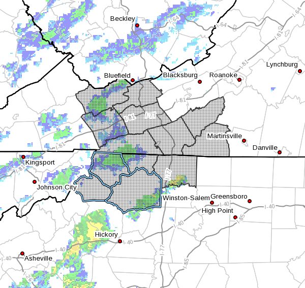
NCZ001>003-018-019-VAZ007-009-010-012-015>017-032-171545-
/O.NEW.KRNK.FF.A.0007.210817T1200Z-210818T1600Z/
/00000.0.ER.000000T0000Z.000000T0000Z.000000T0000Z.OO/
Ashe-Alleghany NC-Surry-Watauga-Wilkes-Tazewell-Smyth-Bland-Wythe-
Grayson-Carroll-Floyd-Patrick-
Including the cities of Wilkesboro, Dobson, Whitetop, Sparta,
Volney, West Jefferson, Tazewell, Wytheville, Floyd, Marion, Galax,
Boone, Stuart, Bland, Independence, and Troutdale
337 AM EDT Tue Aug 17 2021
…FLASH FLOOD WATCH IN EFFECT FROM 8 AM EDT THIS MORNING THROUGH
WEDNESDAY MORNING…
The National Weather Service in Blacksburg has issued a
- Flash Flood Watch for portions of North Carolina and southwest
Virginia, including the following areas, in North Carolina,
Alleghany NC, Ashe, Surry, Watauga and Wilkes. In southwest
Virginia, Bland, Carroll, Floyd, Grayson, Patrick, Smyth, Tazewell
and Wythe. - From 8 AM EDT this morning through Wednesday morning.
- Rainfall amounts of 2 to as much 5 inches of rain are expected to
occur today into early Wednesday. Locally higher amounts are
possible. - This very heavy rainfall may push many streams and creeks out of
their banks, resulting in flooded roads. Mudslides may develop
along steeply sloped terrain.
PRECAUTIONARY/PREPAREDNESS ACTIONS…
You should monitor later forecasts and be prepared to take action
should Flash Flood Warnings be issued.


