


Weather AlertsWeather Warning
Special Weather Statement for Watauga County, NC – Thursday July 23, 2020
Last Updated on July 23, 2020 7:14 pm
Watauga-
709 PM EDT Thu Jul 23 2020
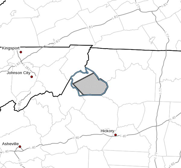
…A STRONG THUNDERSTORM WILL AFFECT WATAUGA COUNTY…
At 708 PM EDT, a strong thunderstorm was located near Foscoe, moving
northeast at 15 mph.
Winds in excess of 30 mph and pea size hail are possible with this
storm.
Locations impacted include…
Boone…
Blowing Rock…
Foscoe…
Sugar Grove…
Deep Gap…
Todd…
and Blowing Rock.
Torrential rainfall is also occurring with this storm, and may cause
localized flooding. Do not drive your vehicle through flooded
roadways.
Frequent cloud to ground lightning is occurring with this storm.
Lightning can strike 10 miles away from a thunderstorm. Seek a safe
shelter inside a building or vehicle.


