


Last Updated on February 6, 2020 5:02 am
FLOOD WATCH REMAINS IN EFFECT THROUGH FRIDAY MORNING
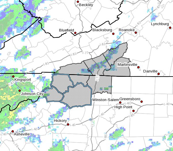
The Flood Watch continues for
* Portions of North Carolina and Virginia, including the following areas, in North Carolina, Alleghany NC, Ashe, Caswell, Rockingham, Stokes, Surry, Watauga, Wilkes, and Yadkin. In Virginia, Amherst, Appomattox, Bedford, Buckingham, Campbell, Carroll, Charlotte, Floyd, Franklin, Grayson, Halifax, Henry, Patrick, and Pittsylvania.
* Through Friday morning.
* An extended period of rainfall with high rainfall rates and thunderstorms on Thursday create favorable conditions for flooding. Rainfall totals of 3 to 4 inches with locally higher amounts over 5 inches possible along the Blue Ridge.
* The ground will be saturated when thunderstorms are most likely. High rainfall rates inside of these storms could potentially create rapid water rises, especially in small creeks and streams, areas with poor drainage, and low lying areas.
PRECAUTIONARY/PREPAREDNESS ACTIONS
A Flood Watch means there is a potential for flooding based on current forecasts.
You should monitor later forecasts and be alert for possible Flood Warnings. Those living in areas prone to flooding should be prepared to take action should flooding develop.


