


Last Updated on February 13, 2022 8:44 am
Update Wednesday Feb 8 3:40pm – The wind advisory has been changed to a High Wind Warning from 4am Thursday to midnight Thursday night. Gusts up to 60 mph possible. Also below is a video update from Brad Panovich on the storm threat for tonight.
Update Wednesday Feb 8 12:30pm – A Wind Advisory is effect from 7am to 7pm Thursday. According to the Advisory, “Gusty winds begin to develop by early morning Thursday, with the strongest wind gusts expected from mid-morning into the afternoon. Wind gusts will then lower by early evening Thursday.”
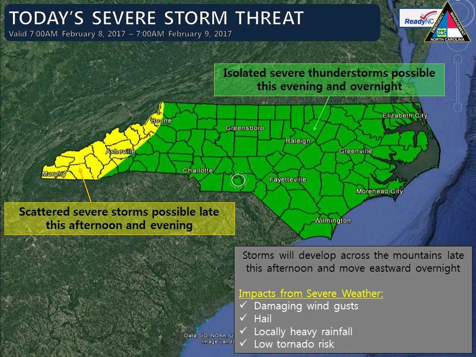
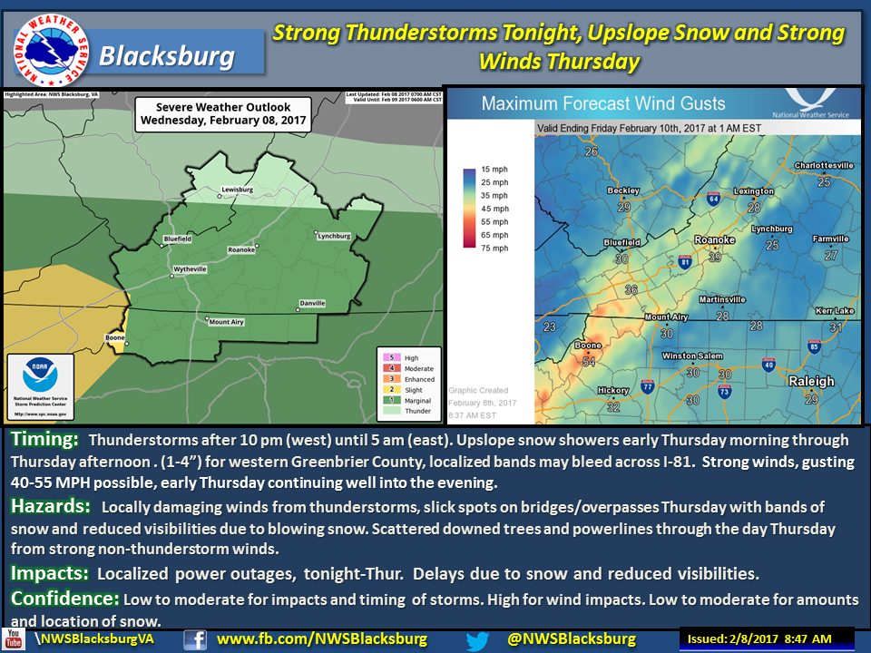
With Monday and Tuesday recording high temperatures in the 60's to start the week, a return to winter will occur later this week. Fans of cold and snow will enjoy the change over starting on Thursday, as high temperatures are forecast to only reach into the mid 30s to start with before dropping into the 20s. As lingering rain is left over from Wednesday night it will change over to snow in the early morning hours of Thursday, according to the National Weather Service(NWS).
Snowfall amounts are forecast to be between 1-4 inches on the western slopes in northwest North Carolina. Other locations in the mountains are currently forecast to see flurries and according to NWS “maybe a snow burst or two” would could coat the ground with a dusting to half an inch. NWS also says that due to the recent warm trend, accumulations on roads could take a while in the higher elevations.
The other weather story will be the strong winds. Gusts up to 55 mph will be possible Thursday afternoon and into the night. Single digit wind chills are very likely for Thursday through Friday night. High temperatures are forecast to bounce back into the 50s and 60s for Saturday and Sunday.


