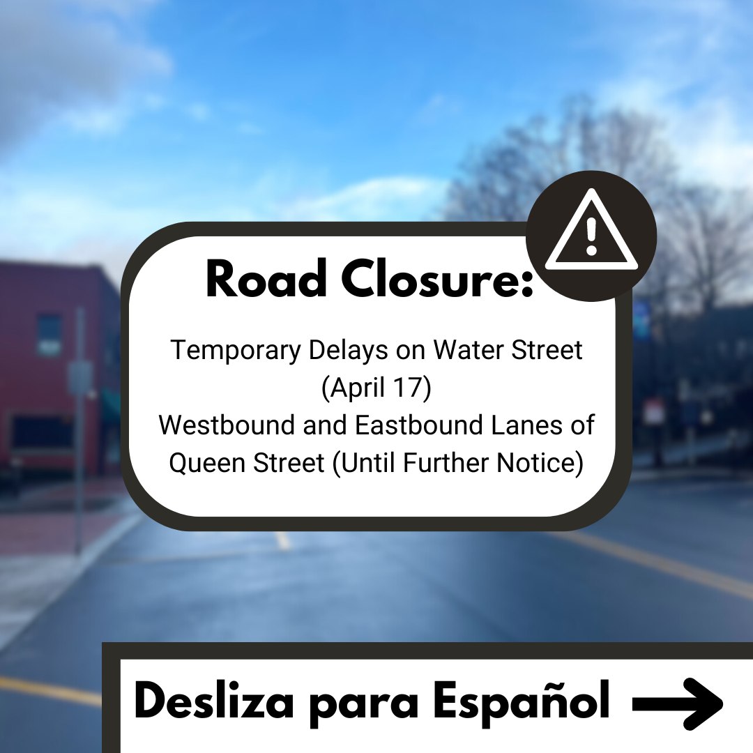
Last Updated on April 2, 2017 5:43 pm
April 4, 2017 UPDATE – Slight risk of thunderstorms is likely late Wednesday and Wednesday night, according to the National Weather Service. Damaging wind gusts will also be a threat for Thursday afternoon into early Saturday. The Weather Service says that a wind advisory will likely be issued, and a High Wind Warning may be needed for locations above 3,000 feet.
Snow showers are still likely for Thursday evening through Friday night. Minor accumulations could occur.
April 2, 2017 – It's shaping up to be quite the busy weather week for the High Country. Showers and thunderstorms are possible as the work week begins. The National Weather Service says that heavy rain and the potential for flooding is possible for late Monday and into Monday night. Along with the continued chance of showers for Tuesday, winds will noticeable pick up with gusts approaching 50 mph. More heavy rain will be possible for Wednesday which could cause localized flooding late in the day.
Strong winds will again become an issue for Thursday and Friday, with gusts approaching 50 mph. Falling temperatures on Thursday night and into Friday could produce snow showers in the area, before the return of sunshine for the weekend.