Last Updated on February 13, 2022 8:48 am
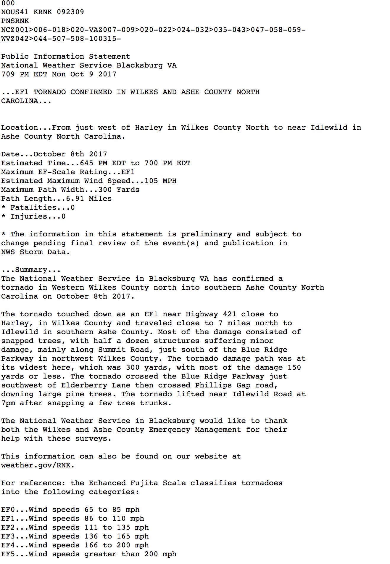
Update Tuesday October 10 – NWS has released more details about the tornado in Wilkes and Ashe.
According to a statement: The tornado touched down as an EF1 near Highway 421 close to Harley, in Wilkes County and traveled close to 7 miles north to Idlewild in southern Ashe County. Most of the damage consisted of snapped trees, with half a dozen structures suffering minor damage, mainly along Summit Road, just south of the Blue Ridge Parkway in northwest Wilkes County. The tornado damage path was at its widest here, which was 300 yards, with most of the damage 150 yards or less.
The tornado crossed the Blue Ridge Parkway just southwest of Elderberry Lane then crossed Phillips Gap road, downing large pine trees. The tornado lifted near Idlewild Road at 7pm after snapping a few tree trunks.
Monday October 9, 2017 7:11pm – A National Weather Service survey team has announced that the storm survey has been completed for the tornado in Wilkes and Ashe counties on Sunday night.
An official with the National Weather Service Blacksburg office tells WataugaOnline.com that the tornado was an EF1, with a maximum width of 300 yards. No damage was found south of Highway 421 in Wilkes County as of 7pm.
The official also tells WataugaOnline.com that the survey team is currently in southwest Wilkes looking for possible damage.