Last Updated on February 13, 2022 9:02 am
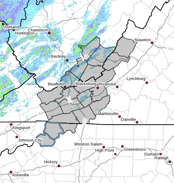
NCZ001-002-018-VAZ007-009>020-WVZ042>044-507-508-250500-
Ashe-Alleghany NC-Watauga-Tazewell-Smyth-Bland-Giles-Wythe-
Pulaski-Montgomery-Grayson-Carroll-Floyd-Craig-Alleghany VA-Bath-
Mercer-Summers-Monroe-Eastern Greenbrier-Western Greenbrier-
Including the cities of West Jefferson, Sparta, Boone, Tazewell,
Marion, Bland, Pearisburg, Wytheville, Radford, Pulaski,
Blacksburg, Independence, Whitetop, Troutdale, Volney, Galax,
Floyd, New Castle, Clifton Forge, Covington, Hot Springs,
Bluefield, Flat Top, Hinton, Hix, Union, Lewisburg,
White Sulphur Springs, Alderson, Quinwood, Duo, and Rainelle
742 PM EST Sun Dec 24 2017
…Locally slippery conditions expected to develop in the
mountains before midnight…
A strong cold front will sweep east through the region before
midnight. Strong gusty winds, rapidly falling temperatures, and
scattered snow showers will accompany and follow the front. By
midnight, localized snowfall accumulations of around 1 inch are
possible, especially west of Interstate 81.
With temperatures falling below freezing, and increasing winds
which may blow some of the newly fallen light snow, roadways will
likely become increasingly slippery. Motorists traveling later
this evening are urged to be aware of rapidly changing weather
conditions and exercise caution while driving.