Last Updated on February 13, 2022 9:01 am
Update Wednesday Dec 6, 2017 – Here's some updated information about the cold and possible snow for the rest of the week and weekend.
Snow and bitter cold is still in the forecast for the end of this week and weekend. High temps are forecast to top out in the mid 30s on Thursday and Friday. Snow is forecast to begin on Friday with little or no accumulation. Wind chill values in the single digits will be likely Saturday night all the way through Monday morning.
The cold weather will remain well into next week at least, as snow will be possible again Tuesday through Wednesday morning.
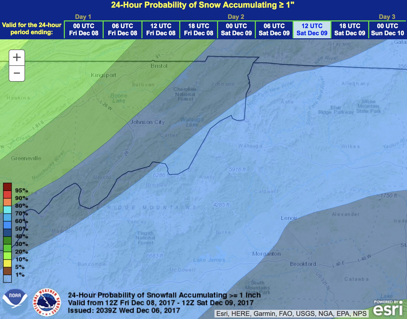
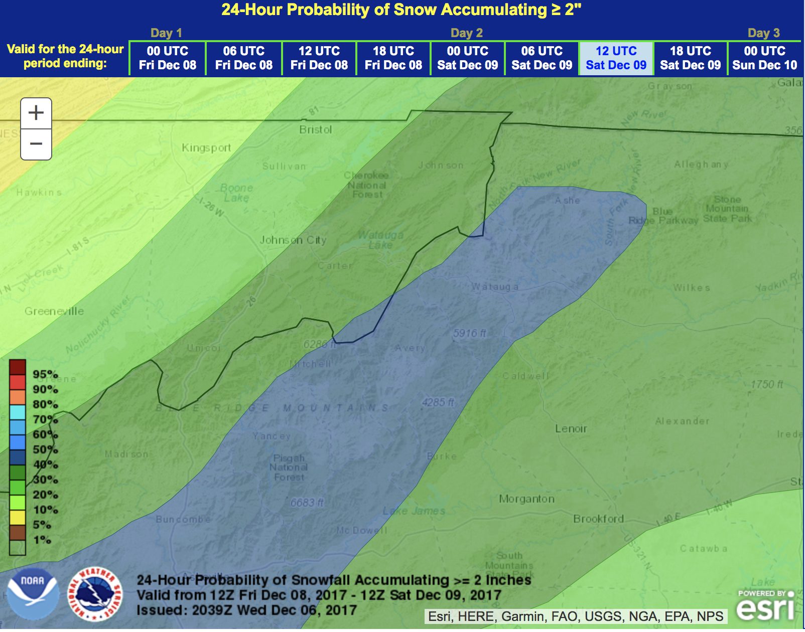
Weather model probabilities of greater than/equal to 1 inch and 2 inches of snow through Saturday morning.
With meteorological winter starting on Friday December 1, it will feel more like winter for the coming week.
The arrival of much colder air will arrive by mid week, according to the National Weather Service. Below normal temperatures are forecast for the middle of the week into the weekend. NWS says that temperatures are expected to be 10 degrees below normal by Friday and Saturday. Highs Wednesday through Sunday will be in the 30s, with wind chill values in the single digits for the weekend.
The next appearance of snow could occur for the coming weekend as well. NWS says minor snow accumulations are possible.
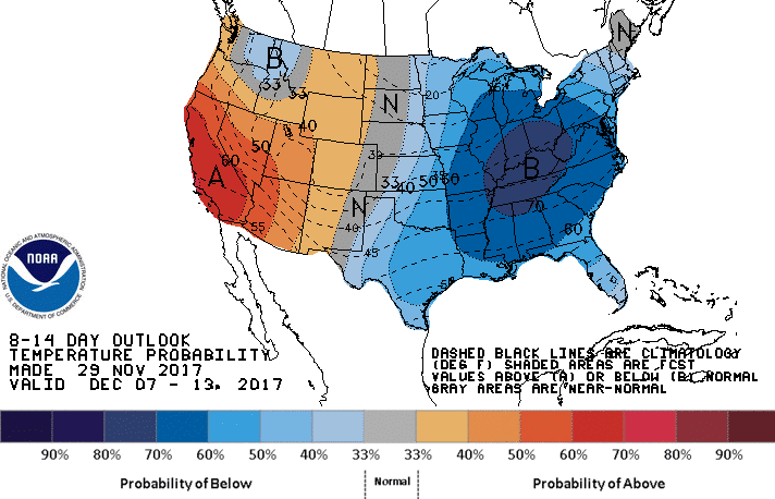
From Thursday, Dec.7th to Wednesday, Dec.13 there is a 60 to 70% chance of below normal temperatures, according to NWS. The chart below is for December 7-13 and was issued on November 29th.