Last Updated on February 13, 2022 9:01 am
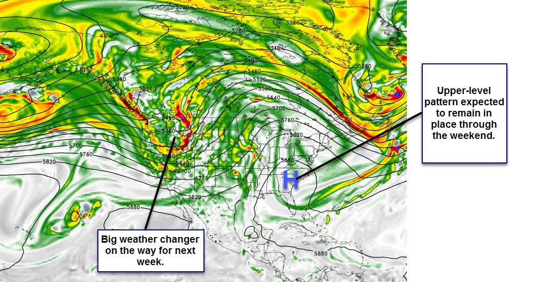
The High Country will be in line to see the first winter-like weather for the season this coming week as big changes are on the way.
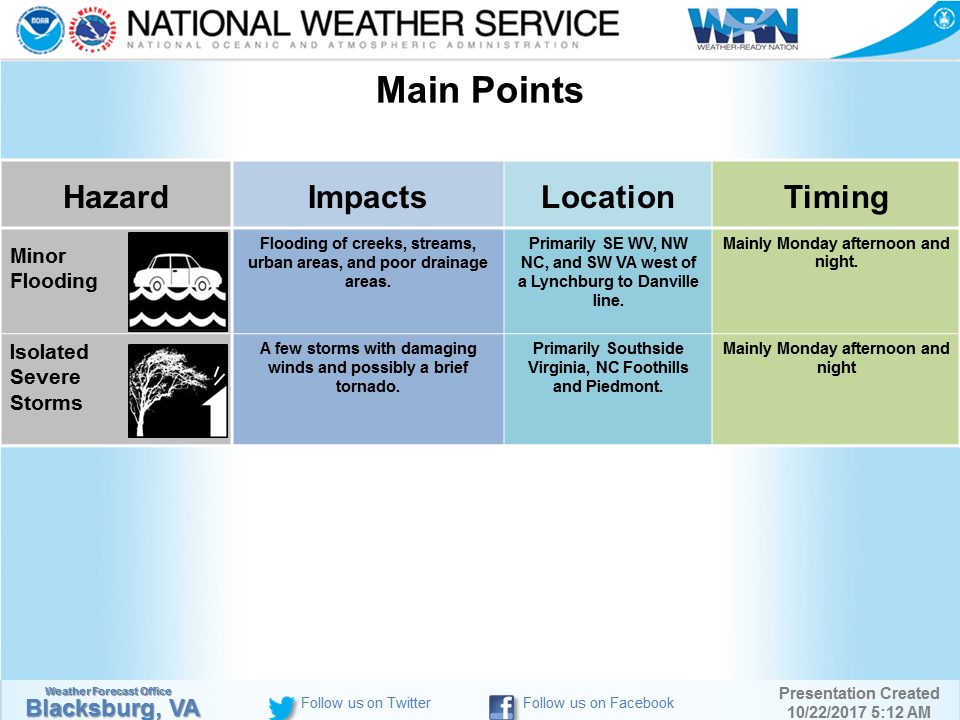
But first, rain could be an issue for the mountains starting on Sunday night. Rain moves in mainly after midnight on Sunday then leading into a slight risk for heavy rainfall Monday afternoon through Tuesday morning, according to the National Weather Service. Periods of heavy rainfall are expected which could result in minor flooding, especially in normally flood prone and low-lying areas.
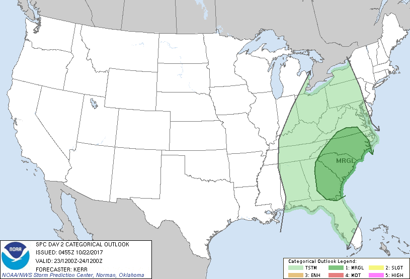
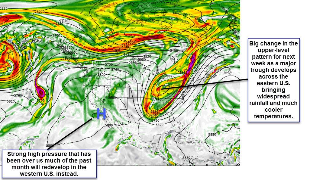
Wind gusts up to 40-45 mph will be possible at the higher elevations of the High Country. There is a marginal risk for severe thunderstorms late Monday afternoon into Monday night. Behind the rain a cold front moves in dropping temperatures into the 50s for highs for Tuesday and Wednesday and into the 30s for Tuesday night and Wednesday night. There is the possibility that any leftover moisture on Wednesday night could change over to isolated snow showers but any accumulation would be little to none.
Temperatures are forecast to rebound into the 50s on Thursday and 60s on Friday with sunshine.
Graphics: NWS
Marginal risk for severe thunderstorms late Monday afternoon into Monday night.