Last Updated on January 25, 2013 8:21 am
*This post will provide updates as to the changing weather conditions across the High Country for Friday Jan 25. Check back for real time updates as information comes in from social media, emails and text.*
15 degrees in Boone at 5am, wind chill of 8 above
Watauga , Avery, Johnson County TN schools are closed
6:08am – already getting some snow reports coming in
6:30am – reports of snow falling across the county.
7:30am – first reports of sleet are coming in
7:40am – no reports of road issues yet though there is some sleet falling in some parts of the county
7:45am – snow and snow/sleet mix currently across much of the county. No road issues yet reported, careful on walkways, porches etc.
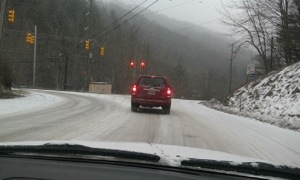
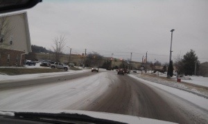
8am – getting first report of some slick roads in Boone
8:20am – several reports of roads becoming slick, especially around Boone. If you are traveling anywhere be advise of possible slick roads
Per AppalCART twitter feed – Friday January 25, 2013 due to slick roads the purple route and the silver route are on limited routes
8:30am – if you are traveling assume your route is SLICK. EMS officials responding to numerous wrecks in the area already
Per DOT – Possible lane closures on 321 in Blowing Rock today. Limited ops due to wintry mix forecast
9am – wrecks are still a big issues this morning as roads are slick. Allow plenty of extra time if you are traveling
NWS Video briefing
9am – 194 north near Clint Norris Road is at a standstill due to a wreck
9:06am – biggest travel issue right now continues to be 194 north near Clint Norris Road due to wreck
9:30am – continue to use caution traveling, more sleet and snow are forecast to fall throughout the day
10am – the number of accidents is way down from earlier this morning. Be aware of more sleet and snow on the way today, especially this afternoon.
10am – 194 north wreck is cleared. Roads are still slick in the area.
10am Broadstone at 105
Wilson Drive at the mall
All ASU classes regardless of beginning or regular dismissal time are to end at 12:00 pm on Friday, January 25, 2013
10:30am – getting a lot of facebook questions about "how will roads be…" at any certain point this afternoon and evening. We still have more sleet, and snow, on the way this afternoon. As was the case this morning it will not take much for roads to be as bad or worse than this morning. Plan accordingly.
Brad Panovich video update
Curly Stumb and his on the spot snowman says at 10:30 AM looking good on Niley Cook Road

Brad Panovich via twitter – Mountain Tweeps things will go down hill fast shortly, very icy as freezing rain moves in from TN. Get ready now! wncwx
11:15am – wreck reported near the Avery County line on 105, vehicle over the embankment. Plan for possible delays.
11:20am – the next round of weather is in East TN now. Latest Winter Weather Advisory update says snow and sleet accumulations of 2-4 inches.
The view on Doctor's Drive at 11:35am

12noon – heavy sleet all across the county.
Radar view of sleet just after noon

12:20pm – Head on collision on 321 just outside Boone towards Blowing Rock at Niley Cook Road
12:27pm NORTHBOUND LANE OF 321 is BLOCKED at Niley Cook Road due to wreck per scanner.
12:45pm – roads are getting/have gotten slick again from this sleet. Caution traveling
The scene on 321 at Niley Cook Road

1:10pm – 321 wreck at Niley Cook Road is cleared
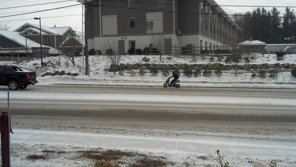
Cool photo of the sleet. Photo: Eric Heistand

LOTS of offices/businesses closing early today. Before you travel, call to make sure your destination is still open
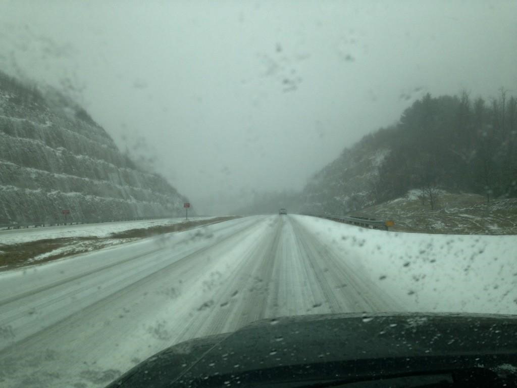
The view coming into Boone on 421 mid afternoon. Submitted via twitter by @TMIsaac
On the 105 extension
3pm – The weather system is starting to clear out some. Most of the sleet and snow has fallen, BUT we still have little more on tap for the rest of today and tonight. Winter Weather Advisory is still in effect until midnight. Continue to use caution on area roadways.
3:30pm – If you are traveling off the mountain check the forecast and conditions in that area. There are NUMEROUS twitter reports of accidents in the Piedmont and around Charlotte. Continue to use caution on local roads too.
4:45pm – Continue to keep in mind that there are plenty of slick spots still in the area. For those traveling off the mountain lots of accidents in the foothills and piedmont and Charlotte area. Allow plenty of extra time.
5:00 PM overturned pick up on right lane going south 321 toward Blowing Rock, near Mustardseed.
5:18pm via facebook – Globe Rd. is ok from the top at Blowing Rock.
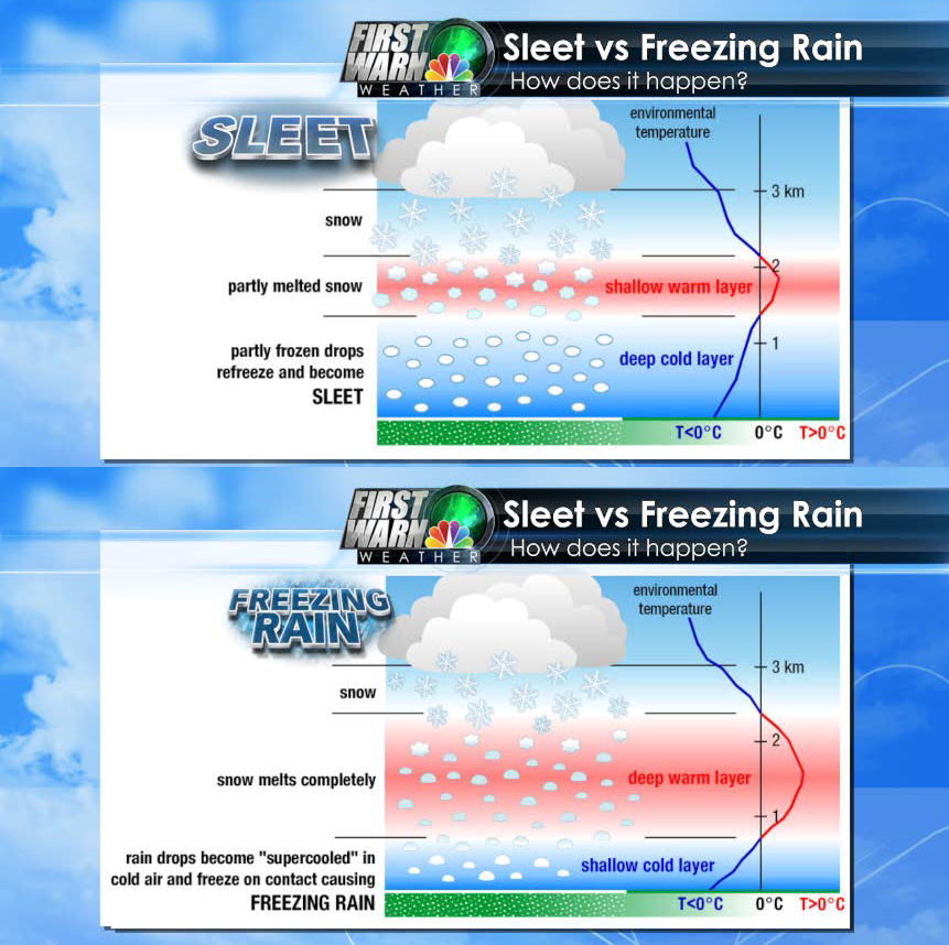
This shows why this weather event was mostly sleet and not snow. Graphic via Brad Panovich, WCNC TV36
6pm – Accident reports have tampered off this early evening. Still many slick spots around the High Country so keep that in mind if you are traveling.
Weather Note: The low was 15 at multiple times throughout the day, at 5:55pm it is 32 degrees in Boone for the high on the day.
6:15pm – the winds are howling. Gusts are close to 30mph already and are forecast tonight, wind chill values in single digits.